
Industry Solutions

Drone Surveying & Mapping Solutions for Construction Engineers and Site Planning

At Robota, we provide drone photogrammetry for construction engineers to efficiently plan and manage their projects.

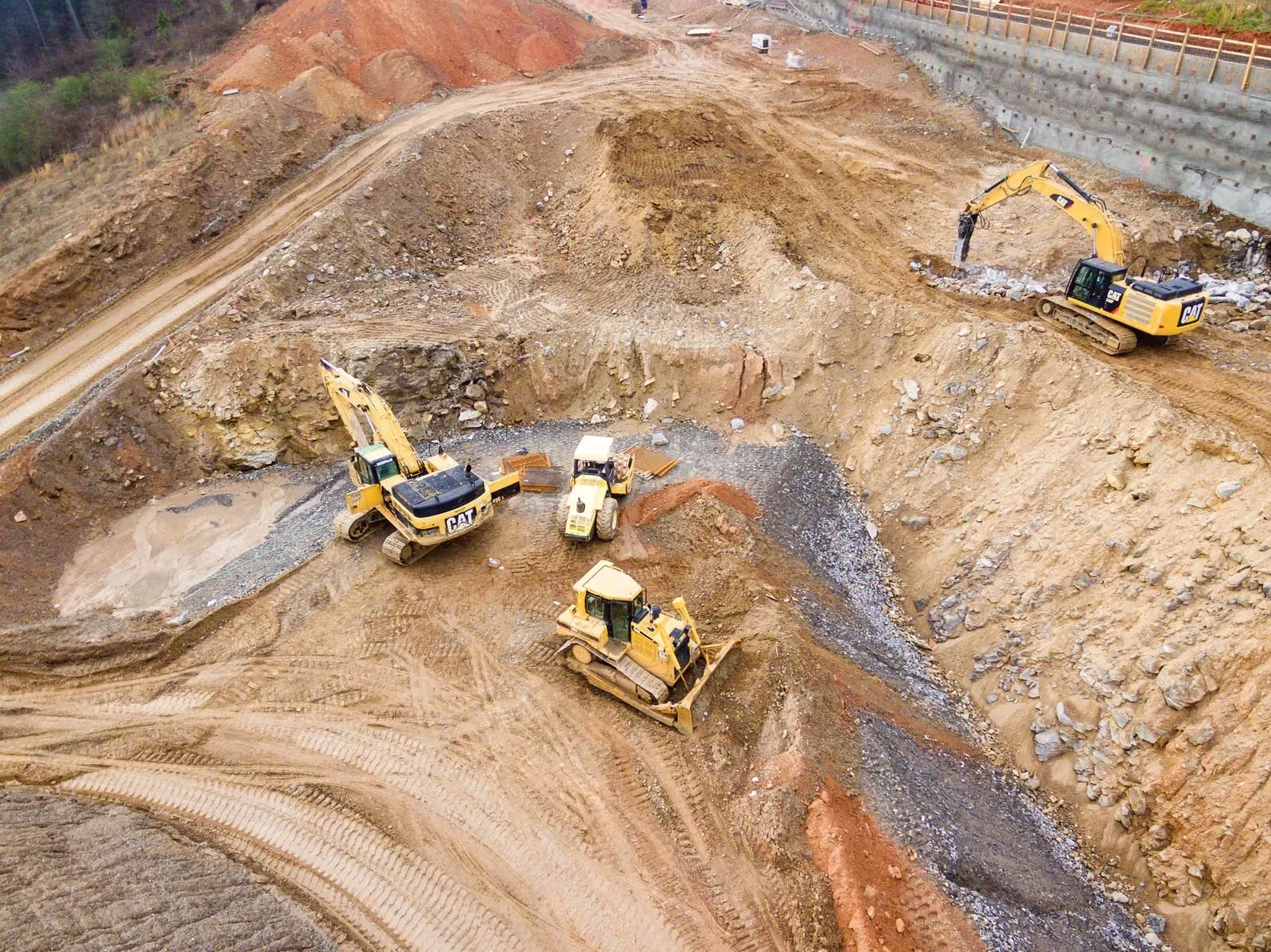
Our drone surveying for construction sites delivers accurate geospatial data that supports faster planning, progress monitoring, and regulatory compliance across all project phases.

Drone aerial imagery helps engineers plan projects during pre-construction or bidding phases. Even in the completion phases, UAVs can be used to verify as-built construction.

Whether you need drone building surveys to assess structural alignment or drone construction site surveys to capture real-time updates, our drone mapping for construction enables smarter decision-making from day one.

Why it works

Our UAV solutions use drone survey equipment for 3D site modeling and volumetric analysis. Durable drone photography equipment aids as-built verification and BIM overlays, improving safety and reducing rework costs.

Applications

What teams accomplish in the field

Earthwork Progress Tracking with Drone Construction Surveys

Fixed wing drones are ideal tools for managing earthworks projects. The elevation map output from drone data can be used to effectively track quantities, understand cut, fill volumes, and most importantly, stay on schedule.

With our construction drone survey capabilities, you can produce high-resolution elevation models and volumetric measurements, ensuring accurate reporting and project tracking at every earthmoving stage.

Drone Building Surveys for Infrastructure Monitoring

Monitoring infrastructure and rights-of-way is faster with drone imagery. Orthomosaics help assess overgrowth and intrusions more efficiently than long videos or visual notes.

Drone building surveys and corridor mapping streamline infrastructure inspections, reducing the need for manual site visits and enhancing safety while increasing operational efficiency.

Drone Surveying for Construction Site Management

Accurate drone surveying data of a construction site can be used across all phases, from site prep to post-construction documentation, helping engineers and stakeholders align on deliverables. Since drone data is on demand, covering the as built results of a construction site can be obtained quickly at the end of a project in order to document the project and demonstrate accuracy of the deliverable.

Recommended Tools

Robota solutions for this industry

RoboDot Touch RTK GNSS

Survey-grade base, rover, and smart ground control point for centimeter-accurate positioning in any workflow.

Metashape Pro

Professional photogrammetry software that turns drone imagery into orthomosaics, point clouds, and 3D terrain models.

Dot3D

Real-time 3D scanning software for capturing as-built conditions with handheld devices and depth sensors.

FAQ

Common questions

Can drones be used in construction?

Yes, drones are widely used in construction for surveying, monitoring, and inspections. A well-equipped drone for construction can capture high-resolution imagery, generate 3D site models, and streamline site progress tracking, reducing labor time and enhancing accuracy.

What is drone surveying in civil engineering?

Drone surveying for civil engineering involves using UAVs to collect topographic data, inspect infrastructure, and support design validation. This method accelerates workflows, lowers field risks, and delivers reliable data for informed decision-making. It also provides historical records, allowing comparisons between as-built models and as-designed plans.

How are drones used in construction engineering?

In construction engineering, drones are used to survey land, monitor job site progress, inspect structural elements, and manage materials. Drone surveying for construction offers precise geospatial data that enhances planning, compliance, and reporting.

What are three examples of how drones can be used in construction?

Common applications include:

1. Aerial site surveys to generate topographic maps.

2. Drones for construction inspection of hard-to-reach structures like rooftops or scaffolding.

3. Progress tracking and documentation through time-lapse imaging.

How can drones improve project construction monitoring?

Drones for construction monitoring enable real-time progress updates, better communication between stakeholders, and quick issue identification. High-frequency aerial data helps teams stay aligned and projects on schedule.

How accurate is drone mapping for construction sites?

When using RTK or PPK-enabled systems, drone surveying for construction can achieve centimeter-level accuracy, sufficient for layout planning, volume calculation, and surface modeling.

What deliverables can be generated from drone mapping in construction?

Drone surveys generate orthomosaic maps, 3D terrain models, point clouds, volumetric measurements, and contour lines. These outputs are critical for drones surveying for civil engineering applications such as grading, cut/fill analysis, and QA.

What is an orthomosaic map and why is it important for construction?

An orthomosaic map is a high-resolution, georeferenced aerial image stitched from multiple drone photos. In drone surveying for construction, orthomosaics offer true-scale accuracy, ideal for planning, inspections, and site audits.

What advantages are there in using fixed-wing drones for earthwork projects?

Fixed-wing drones for construction provide longer flight times and cover larger areas efficiently, perfect for earthwork projects requiring broad aerial coverage and high-frequency data capture.

How do drones improve project planning and verification in construction?

Drone surveying for construction helps align design plans with real-world progress. It provides quick, accurate site data that reduces errors, improves material planning, and ensures contractors meet milestones.

How does drone mapping reduce costs and save time in construction projects?

By replacing manual surveying and inspection tasks, drones surveying for civil engineering cut labor costs, reduce safety risks, and deliver faster turnaround on critical data, accelerating decision-making and project completion.

Ready to put precision to work?

Whether you concentrate on earthwork, infrastructure, or construction, our applications will help you get the job done. For more information about how we can help you improve productivity with our drone photogrammetry for construction engineers, contact us today. Unlock the full potential of drone surveying and mapping for construction projects and experience the speed, safety, and precision it delivers to every site survey and inspection.

Talk to Robota